TM 1-1510-218-10
3-30
3. Rotate the right outer knob until the
cursor is positioned over the identifier
adjacent to REF.
4. Use the right inner and outer knobs to
select the desired identifier.
5. Press the ENT button to display the
waypoint page for the identifier just
entered.
6. Press the ENT
button
again
to
approve the waypoint page. The
intersection page is displayed with the
computed radial and distance.
7. Press the right CRSR button to turn
off the right cursor function.
x. Supplemental
Waypoint
Page.
Supplemental waypoints are user-defined waypoints
that have not been defined specifically as an airport,
VOR, NDB, or Intersection. Supplemental waypoints
also include ARTCC center waypoints and reference
waypoints discussed later. The following information
is displayed on the supplemental waypoint page.
(1) The name of the identifier of the
supplemental waypoint.
(2) The
position
of
the
supplemental
waypoint expressed in terms of a radial and distance
from a nearby VOR.
(3) The
latitude
and
longitude
of
the
supplemental waypoint.
The identifier of another nearby waypoint may be
entered in the REF field and the page will compute
and display the radial and distance from the nearby
waypoint to the supplemental waypoint. This radial
and distance is not stored with the supplemental
waypoint page and is lost when leaving the page.
y. Creating User-Defined Waypoints. Up to
250 user-defined waypoints may be created. These
waypoints may be defined as a user defined airport,
VOR, NDB, or intersection. If the waypoint doesn't fit
into one of these categories, it may be defined as a
supplemental waypoint.
(1) Creating
A
User-Defined
Airport
Waypoint. A user-defined airport waypoint must
contain an identifier, latitude, and longitude. In
addition, any combination of airport elevation, one
runway length, and associated runway surface (hard
or
soft),
and
remarks
can
also
be
stored.
Communication frequencies cannot be stored on the
APT 4 page, airport services cannot be stored on the
APT 6 page, SID's and STAR's cannot be stored on
the APT 7 page, and approach procedures cannot be
stored on the APT 8 page.
1. Use the right outer knob to select the
airport waypoint pages.
2. Rotate the right inner knob to select
the APT 1 page.
3. Press the right CRSR button to turn
on the right cursor function. The
cursor will appear over the first
character of the identifier.
4. Use the right inner and outer knobs to
select
the
identifier
of
the
user
waypoint. The identifier can be up to
four characters in length. Refer to
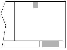
Figure 3-28.
5. To create a waypoint at the present
position, turn the right outer knob
clockwise to position the cursor over
PRES POS? and press the ENT
button. The APT 1 page will now be
displayed
with
the
latitude
and
longitude of the waypoint at the
bottom of the page.
FARM
CREATE NEW
WPT AT:
USER POS?
PRES POS?
CRSR
Figure 3-28. User-Defined Waypoint Page
6. To create a waypoint at a specified
position, place the cursor over USER
POS? and press the ENT button. A
page with the identifier at the top and
dashes at the bottom will not be
displayed. Refer to Figure 3-29.